Rifle Garfield County Airport
Construction Taking Off: Taxiway B & B3 Project Launches This Summer
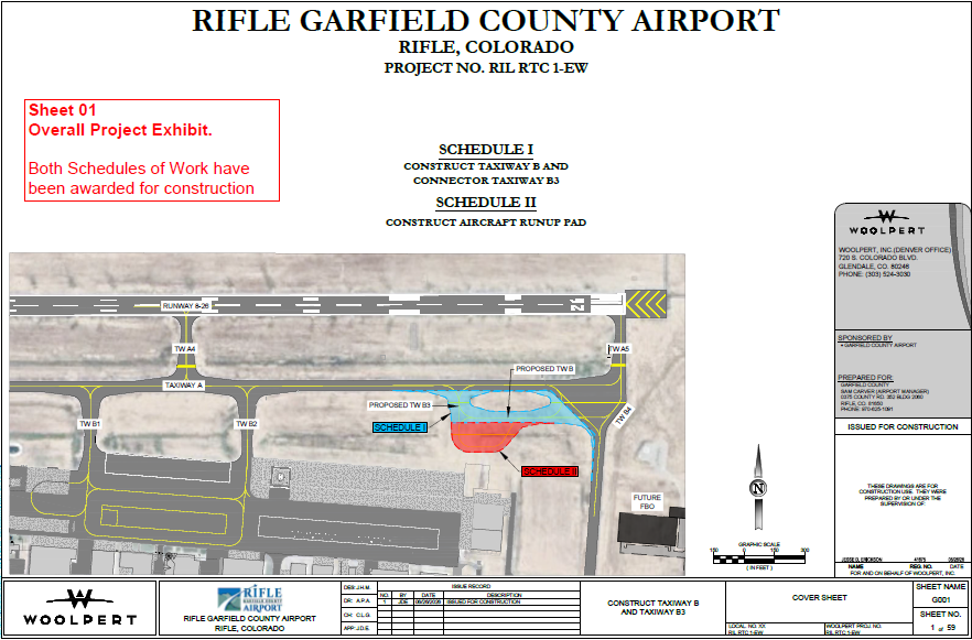
Exciting updates are coming to the airfield! As part of our ongoing commitment to safety, efficiency, and supporting our growing aviation community, the Rifle Garfield County Airport (RIL) is launching the Taxiway B & Connector Taxiway B3 Construction Project this summer.
This project represents a major infrastructure investment in our airport’s future, aimed directly at eliminating operational bottlenecks and ensuring smoother traffic flow on the east side of the airfield.
Why This Project Matters
Over the last few years, Rifle Airport has experienced fantastic growth. While that’s great news for our regional economy, it means our existing taxiways are working harder than ever.
Currently, peak travel periods can create minor bottlenecks on the east side of the airfield – specifically around Taxiway A5 and Runway 26. The new Taxiway B and its companion connector, Taxiway B3, will be constructed south of Taxiway A and west of Taxiway B4. By building this vital bypass, aircraft can circumvent congested areas entirely.
The Bottom Line: Less time waiting on the ramp, reduced congestion, and an overall safer, more efficient environment for pilots, general aviation, and our aerial firefighting partners.
Project Breakdown & Timeline
We are working closely with our engineering firm, Woolpert, Inc., and local contractor Phoenix Industries to complete this project with minimal disruption to daily operations.
• Project Phase: Construction & Management (Summer/Fall 2026)
• Target Completion: End of October 2026
What Pilots & Tenants Need to Know
We are dedicated to keeping our runway open and fully operational throughout the build. However, because safety is our absolute priority, please keep an eye out for active NOTAMs regarding temporary construction closures, shifting taxi routes, or localized flagger activity near the apron.
We appreciate your patience and cooperation as we build a faster, safer, and more capable Rifle Airport!
Questions about the project? Feel free to reach out to the Airport Administrative Specialist.
RIL Taxiway B & B3 Phasing Exhibits
Rifle Garfield County Airport landing fees
The landing fee is calculated at the rate of $4.77 per thousand pounds of maximum aircraft landing weight on all large aircraft of 10,000 pounds or more that are not based here at KRIL.
If applicable, any fees charged by our fixed base operators (FBOs) are separate from the fees billed and collected by Vector.
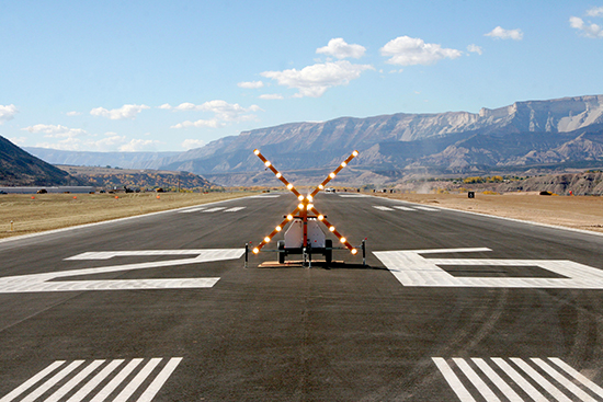
Collision Avoidance
CareFlight
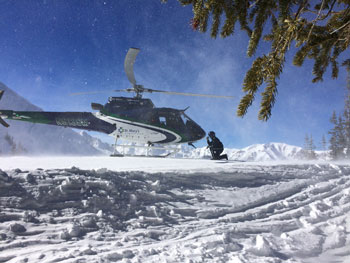
We are proud to host CareFlight here at RIL. CareFlight started providing medical care to Western Colorado in 1976. In 2017, CareFlight brought out a helicopter to the Rifle Garfield County Airport to be closer to the patients in the surrounding counties. The Astar 350 helicopter is staffed with a mountain-trained pilot, a critical care nurse, and a paramedic. For more information, please visit
CareFlight
Weather
For current reported weather, please call:
RIL ASOS t 970-625-2206
Rifle weather averages
Average temperature (high) 64 degrees F – (low) 31 degrees F
Average precipitation 11.61 inches
Average snowfall 38.6 inches
January (high) 37 degrees F – (low), 10 degrees F
July (high) 90 degrees F – (low), 52 degrees F
RIL Obstruction Survey & FAA Instrument Procedure Update: 02APR21
The FAA is currently working with the Armstrong/LEAN/Woolpert team to finalize the processing of the latest aeronautical survey and implement the obstacle information into the next available instrument procedure update. (Then please include the table below)
D
Taxiway, apron construction projects approved
Construction season is taking off at Rifle Garfield County Airport (RIL) with vital congestion-reduction projects cleared to begin. New taxiways and reconstruction of the main airfield apron are designed to improve both efficiency and operational safety.

UAS training facility
A new facility designed to house small unmanned aircraft systems (UAS) and a flight-qualification course is located at the Rifle Garfield County Airport. The CoE will proctor drone training in the building.
UAS training-|

Call before using drones
As drone use becomes popular, we’re seeing an increase in potential conflicts with local aircraft. To ensure the safety of everyone in the air, we kindly request that all drone enthusiasts visit the FAA website (linked below) to check for any potential impact on ongoing aircraft operations.
Federal Aviation Administration-|